
Place Research – Ebbsfleet


The Neighbourhood
Ebbsfleet is fast becoming a thriving neighbourhood centre. Strong hierarchy in the street and public space network emphasises the striking and unique landscape character, where chalk cliffs and lakes are ever present from views around the neighbourhood. The central public square provides a strong focal point, and is successfully fronted by a community building, school and various retail units. In combination these provide encourage a lively place. Whilst parts of the neighbourhood are still under construction, the new community is already developing towards a critical mass of strong ownership and vitality.
Despite a number of areas of good practice, the car is often promoted in design choices. They still are still allowed to dominate the streets of the wider neighbourhood. Even the successful public space dedicates a major interruption through open air car parking. However, priority for cyclists and pedestrians has become much more apparent in the later development phases and encourages more sustainable options.


Generally there is a consistent block structure and alignment:
1. Small blocks, forms high permeability and legible views/desire lines throughout.
2. Form responds to context, position within a wider neighbourhood and/or landform.

Ebbsfleet has been designed with active travel corridors and directions towards aligned to vistas and view corridors, highlighting key routes all look out and encouraging movement towards the lake/cliffs.3. ‘Fastrack’ - connects East-West across the neighbourhood, providing direct routes for pedestrians, cyclists, or via bus.
3. Linkage to existing diverted PRoW (Nene Way) which runs through site connects to adjacent amenity networks, encouraging movement in-out of Upton.
4. Vehicular roads still dominate the movement strategy. Though there are key attempts to provide alternatives: corridors, active travel, they are not dedicated provision and are often quite convoluted in terms of route, navigation.

Key community spaces are provided, with key activities focused around:
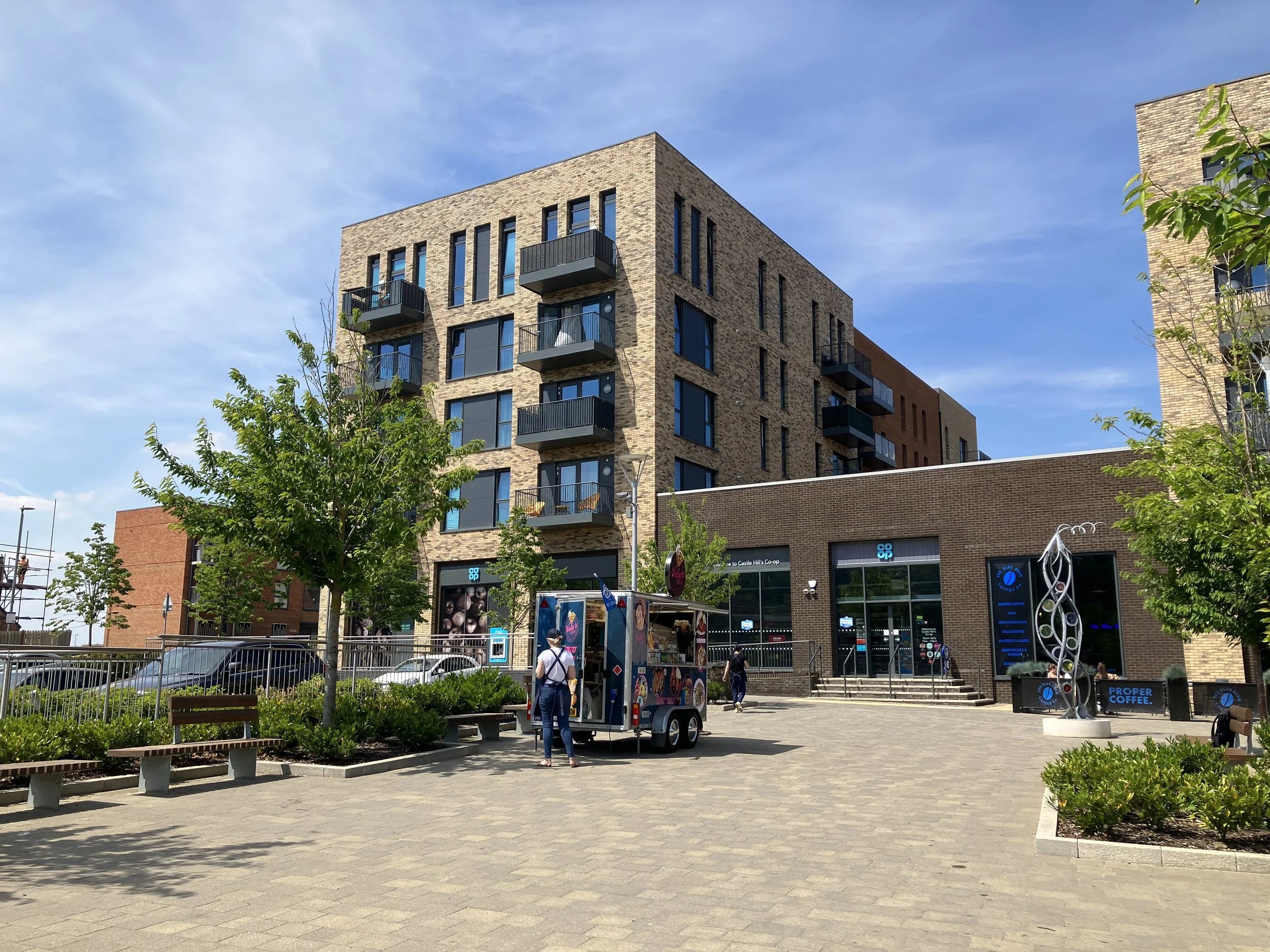
5. Castle Hill Square provides a small central plaza, grouping key uses, retail and community centre/school. Unfortunately a car-park is positioned directly within this space (not adjacent) - it dominates the position and reduces uses and the space quantity and potential as a local landmark.
6. The Village Green aligns to community uses and movement spine (fastrack).
7. Lakeside Park - playground, pulls users towards the lake, which provides an extensive range of options for walks and various types of recreational leisure in and around water. The cliffs surrounding the southern edge form a major natural landmark feature and point of orientation in the landscape.

8. Lake/landscape, a significant feature of the neighbourhood, providing a strong ecological diversity, much self-generated native elements have been retained and managed to provide a unique local habitat, and key amenity for local community to engage with nature.
9. Strategic G&Bi from Central Swale key.
SPACE - Castle Hill Square


Castle Hill Square Plan
SPACE - Platinum Jubilee Lakeside Park


Platinum Jubilee Lakeside Park Plan
STREET – Fastrack


STREET – Southern Loop Road


STREET – View Corridor
Text to be added


